Planning reports, AI renders and code checks for Ontario
The Future of Urban Intelligence
Start with an Ontario address. We check the property against the by-laws, policies and city map layers that apply, and send back a report with every finding cited.
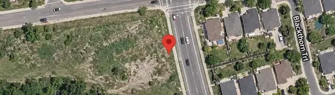 Property IntelligenceType an address, get a cited zoning and planning report.41 municipalities. Free to start.Start a report Planning reports
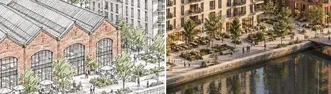 AI RenderingUpload a plan or photo, get a realistic render.Pay per image. Free to start.Try it free Renders from plans and photos
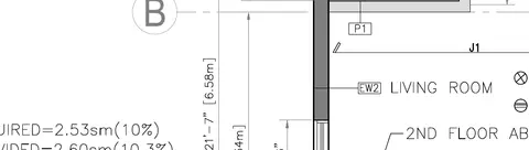 CodeTracePermit drawings checked against the building code.Coming soon.See what it checks Code checks, coming soon
For planners, developers, builders, architects, real estate agents, lenders and homeowners.
01Bring the site
Drop in the drawings, or just type an address.
Site plans, surveys, studies and elevations all work. No files yet? A quick lookup needs only the address.
02Pull every source
We pull the city’s maps for the lot.
Parcel fabric, zoning, Official Plan, floodplain and heritage data, pulled from the city and the conservation authority.
03Check the rules
We check the plan against the zoning by-law.
Yards, height and parking are each checked against the clause that sets them.
04Get the answer
A report anyone can check.
Each finding names the clause or map it came from.
Planning Analysis
The full planning case, with every finding cited.
Site maps
Zoning, policy and constraint maps of the lot.
GIS Analysis
Floodplain, regulation, heritage and servicing.
Quick Lookup
Zoning and key limits for any address.
Our three products.
- 01
Property Intelligence
Planning, zoning and GIS reports across 41 Ontario municipalities.
- 02
AI Rendering
Site plans, elevations and floor plans turned into renders people understand.
- 03
CodeTrace
Permit drawings linked to building code findings, with a reviewer at every step. Available soon.
A site plan for a six storey building beside a ravine develops into a watercolour of the finished site, then into an aerial view with people walking, cycling and playing. Then a concept drawing of a midrise street develops through a watercolour into an aerial render.
Turn drawings into renders.
Upload a site plan, elevation or floor plan and choose a style. You get back a realistic image of the finished project.
Pick your role.
Each one shows what the same address tells you.
Do four townhouses fit the policy and the by-law?
Supportable in principle. The front yard and parking need minor variances.
- 1Official Plan Clear.Residential Low Rise2014 Official Plan, Map 3 and s. 8.2.3.3
- 2Front yard Needs attention.4.35 m, min. 6.0 mBy-law 2024-19, s. 6.3.8.2 D)
- 3Parking Does not comply.6 spaces, 8 requiredBy-law 2024-19, Table 5.3.7
Start withPlanning AnalysisGIS Analysis
SourcesZoning By-law 2024-19 · 2014 Official Plan · TRCA · Markham Heritage Register
What early users say.
It found the holding provision on the lot before I had the by-law open. I still read the clauses myself, but now I start on the right page.
Senior plannerPlanning consultancy, York Region We run a GIS Analysis on every lot before we make an offer. One flagged a conservation authority limit on a site we nearly bought.
Development managerInfill builder, Durham Region The watercolour render did more at the neighbour meeting than our elevations ever did.
ArchitectSmall practice, Toronto
Who we are
AutoCity Labs is a small team in Toronto. Before a municipality goes live we collect its official plan, zoning by-law and map data, write notes on its local standards, and run test reports from start to finish. 41 are live today.
Where the rules come from
- 41Municipalities
Their zoning by-laws, official plans and city map layers.
- 4Provincial sources
The Provincial Planning Statement, Greenbelt Plan, Oak Ridges Moraine Conservation Plan and Land Information Ontario.
- 19Conservation authorities
Regulated area maps, including Toronto and Region, Credit Valley and Conservation Halton.
Drag to look around
Buildings from the City of Toronto 3D Massing, Open Government Licence – Toronto. Map data © OpenStreetMap contributors.